.
Augusto Opdenbosch
Career Highlights
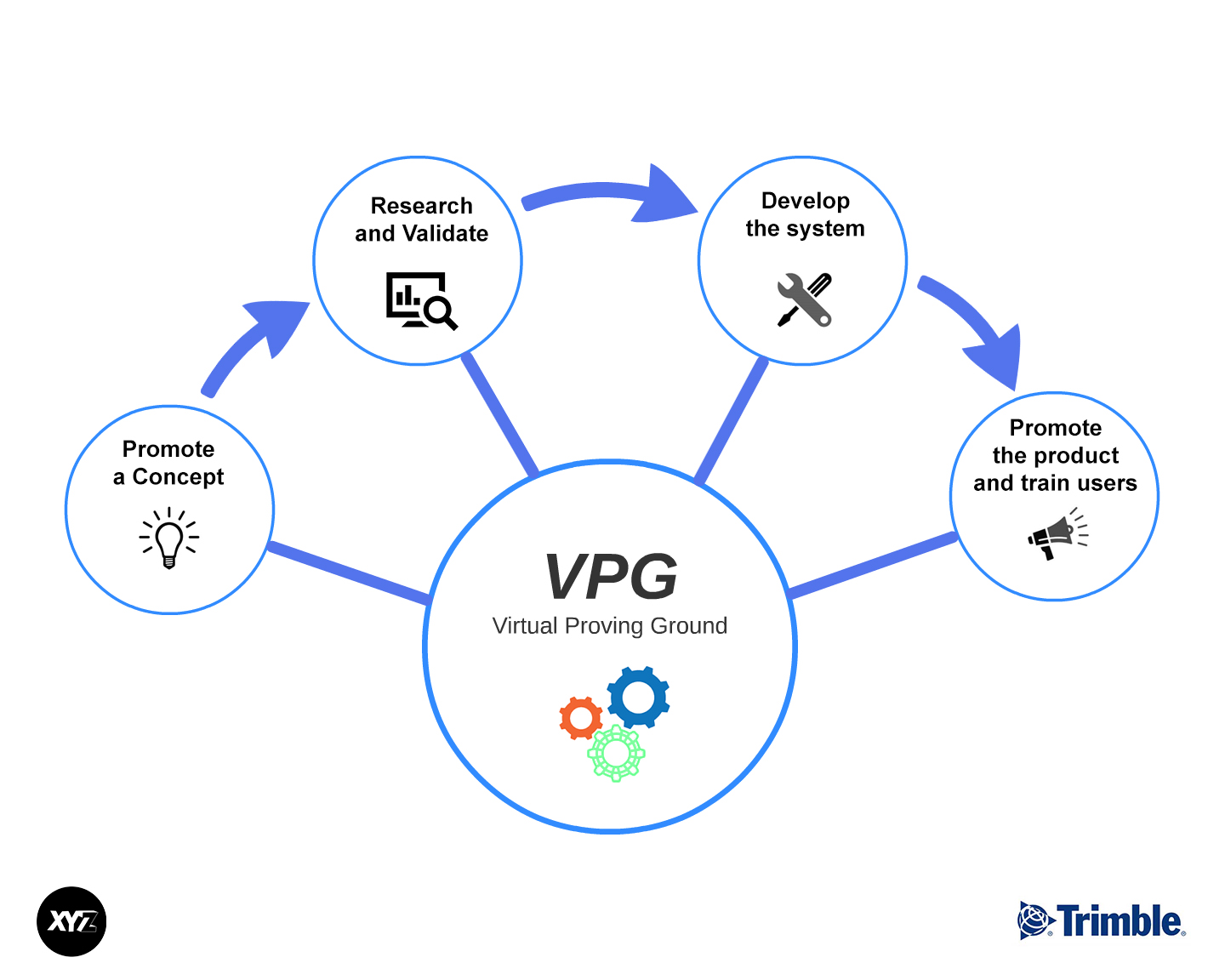
He pioneered the use of Virtual Reality in construction simulation applications while working as a research engineer and post-doctoral fellow from 1994 to 1997 at Georgia Tech. He served as senior research engineer at Spectra Precision Software from 1997 to 2000, where he developed Terravista, Terramodel Visualizer and the Virtual Environment Manager SDK. In 2000, he co-founded XYZ Solutions, Inc. where he led the development team that created XYZ World, a real-time publish-subscribe 3D monitoring suite. After XYZ Solutions was acquired by Trimble in 2006, he started working as a senior research engineer focusing on simulation and visualization projects for several Trimble divisions. In 2011, he pioneered the use of Graphics Processing Units (GPUs) to accelerate image processing and point cloud colorization and was invited to demonstrate the potential of GPU computing to the Trimble Board of Directors. In 2013, Augusto introduced the Virtual Proving Ground (VPG), a comprehensive simulation framework that can be used to propose and test the validity of ideas and also to develop and promote products. Over the last decade, VPG has been used in Building Construction, Geospatial, Mining, Forensics, Civil Engineering Construction, CTCT, ICT, and Ag projects. In 2019, Augusto joined Trimble Autonomous Solutions (TAS) and became the product owner of VPG. He was the technical lead of the simulation team in TAS which was responsible for the development of simulation tools for autonomy projects. In 2022 Augusto was nominated and promoted to the rank of Distinguished Engineer (DE).
Projects
TAS Autonomy Simulators (2019-2023)
Company: Trimble
Comprehensive Simulation Solution Suite for Trimble Autonomous Solutions.
Contributions
Managed simulation group and provided technical advice. Interacted with technical leads in controls, path planning, perception, and systems integration to capture simulation requirements.
Impact
The simulation systems created for TAS developers and testers reduced the amount of time and effort required to test and validate new systems and algorithms. The simulation framework also provided a great platform to communicate concepts to stakeholders and also educate and train new customers.
Role: Product Owner and Technical Advisor
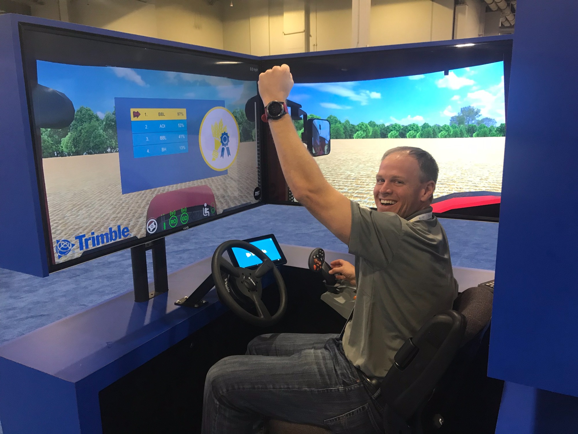
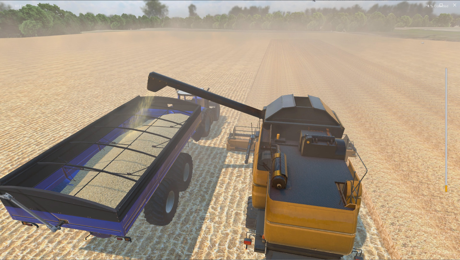
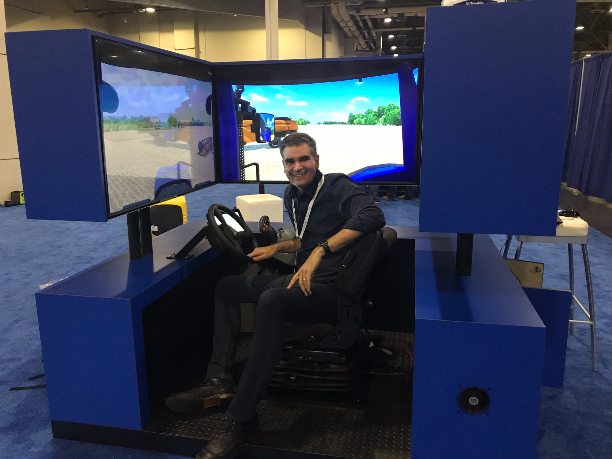
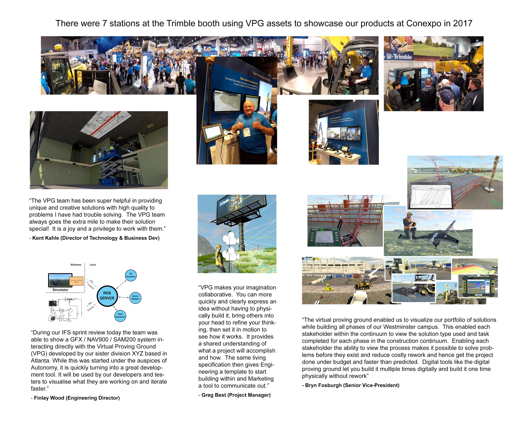
Trimble Dimensions Demo (2018)
Company: Trimble
Gamified Version of Ag Simulator for 2018 Dimensions Conference.
Contributions
Created a game concept where users received points by driving a grain cart alongside a combine in order to collect as much grain as possible. This game featured an immersive multi-display cab with real steering and speed controllers. At the end of the game users got to see how an autonomous driver would perform the same task flawlessly.
Impact
This tradeshow experience was visited by thousand of attendees and received praises for being both fun and informative.
Role: Project Manager and Co-developer
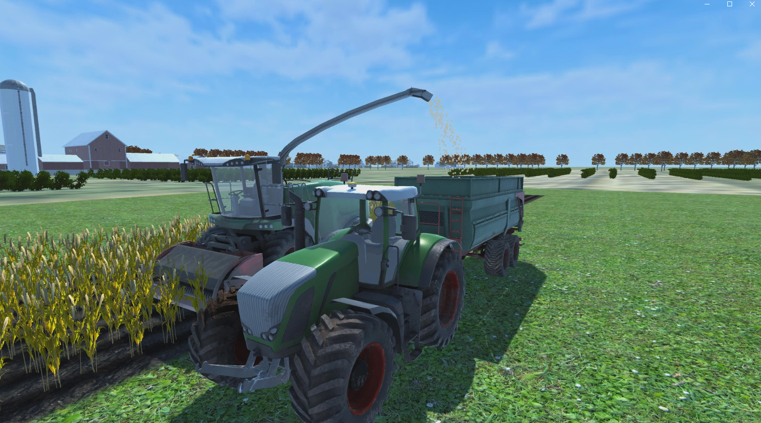
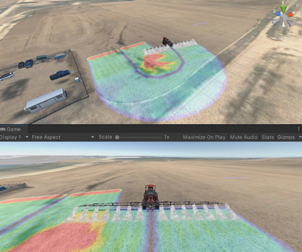
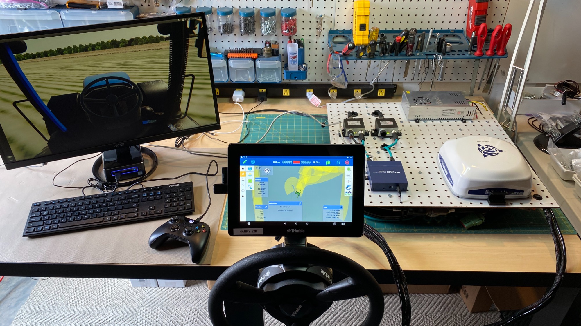
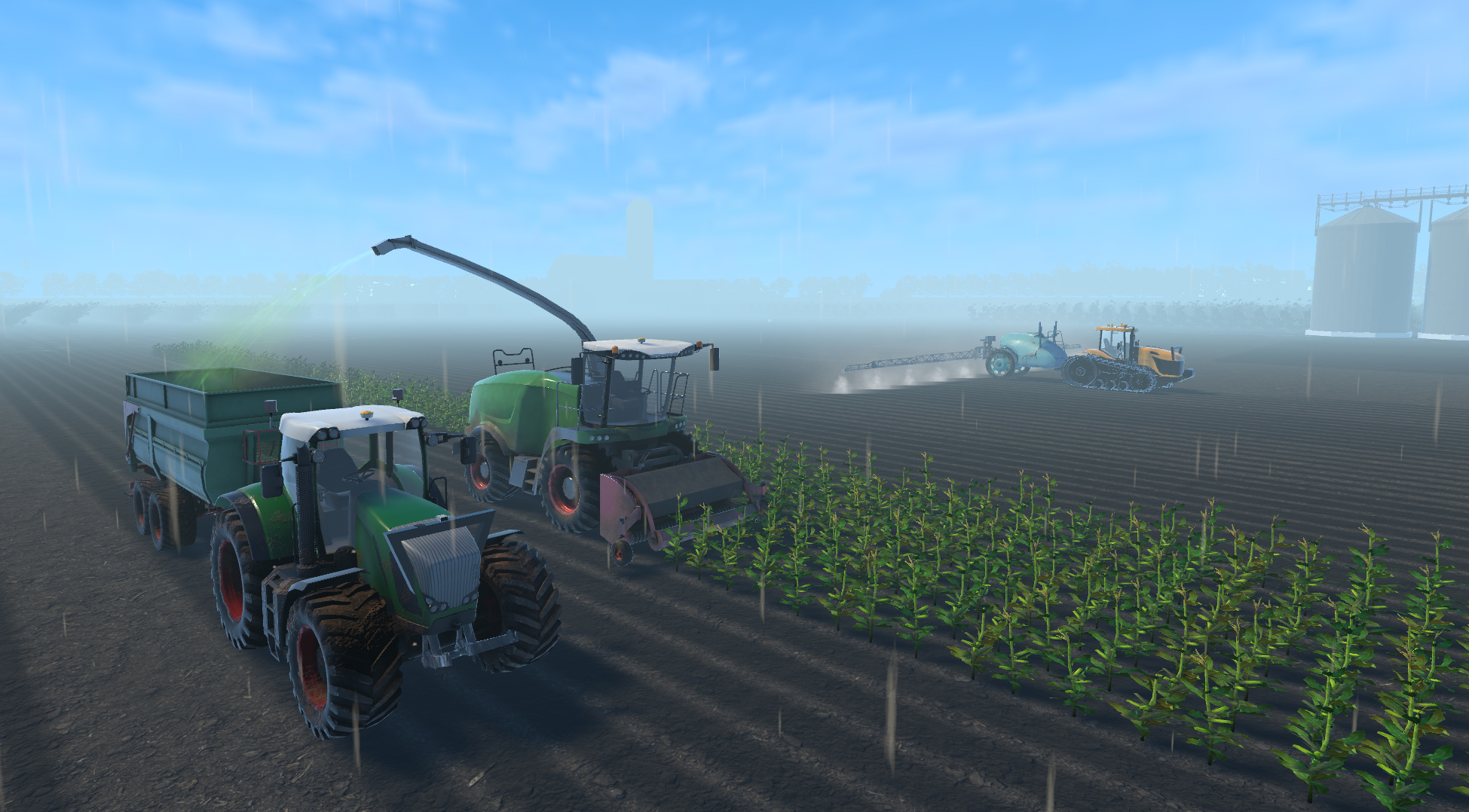
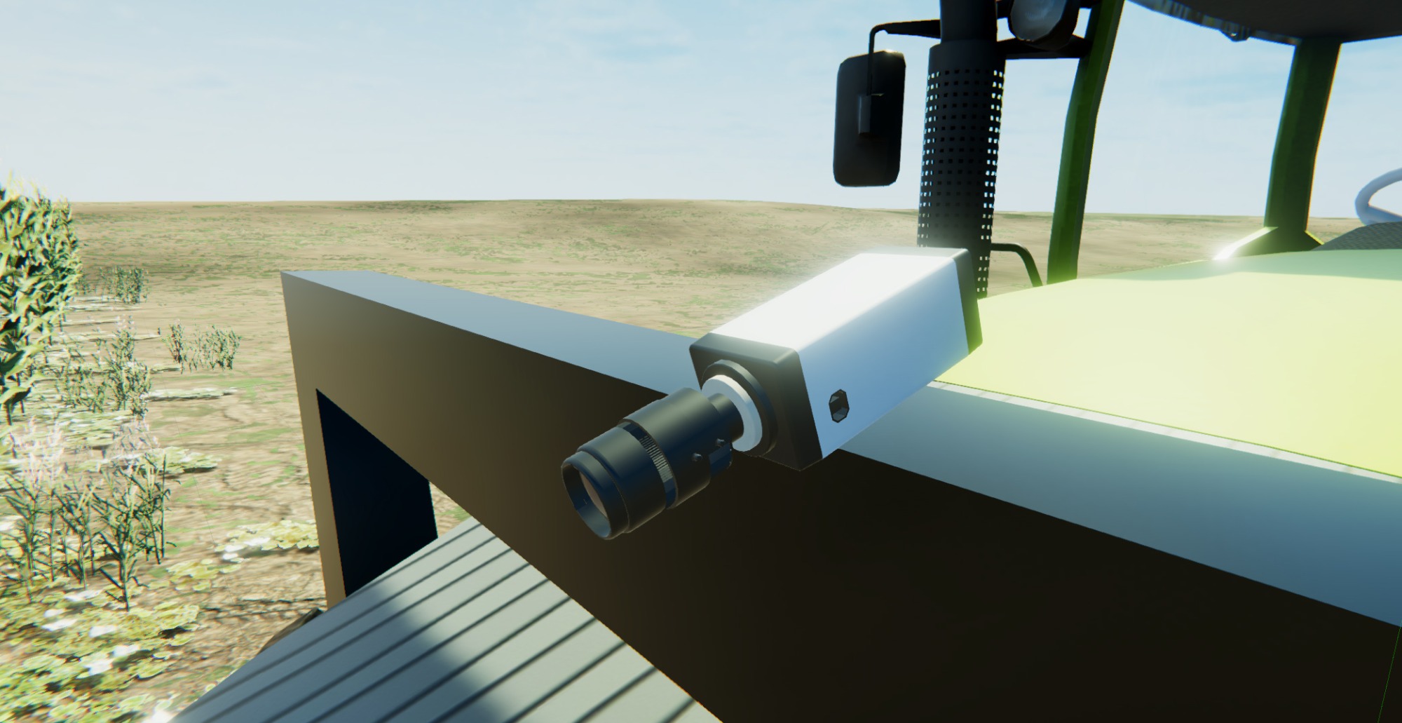
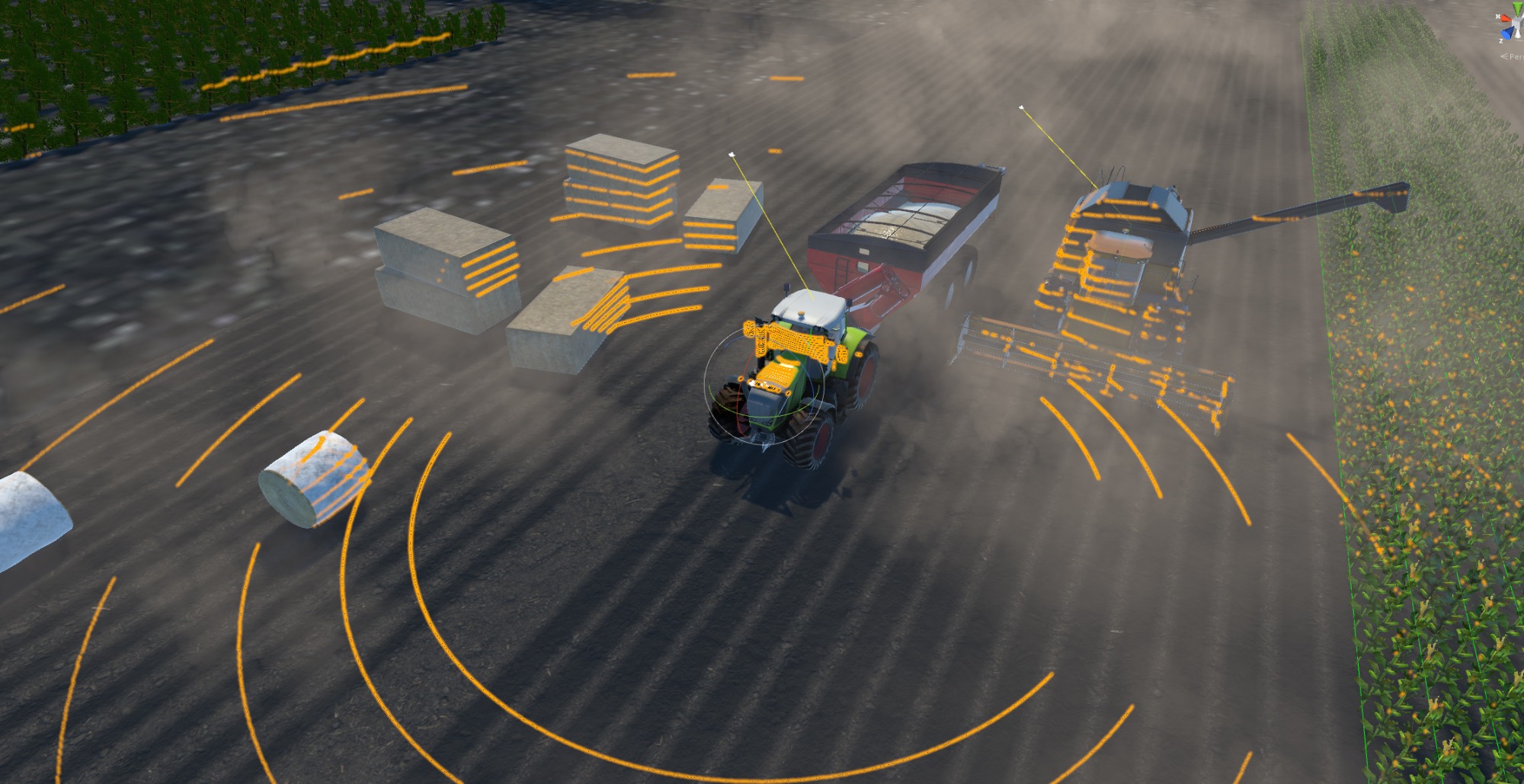
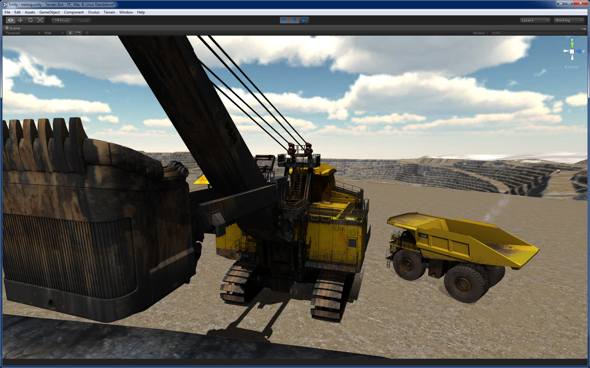
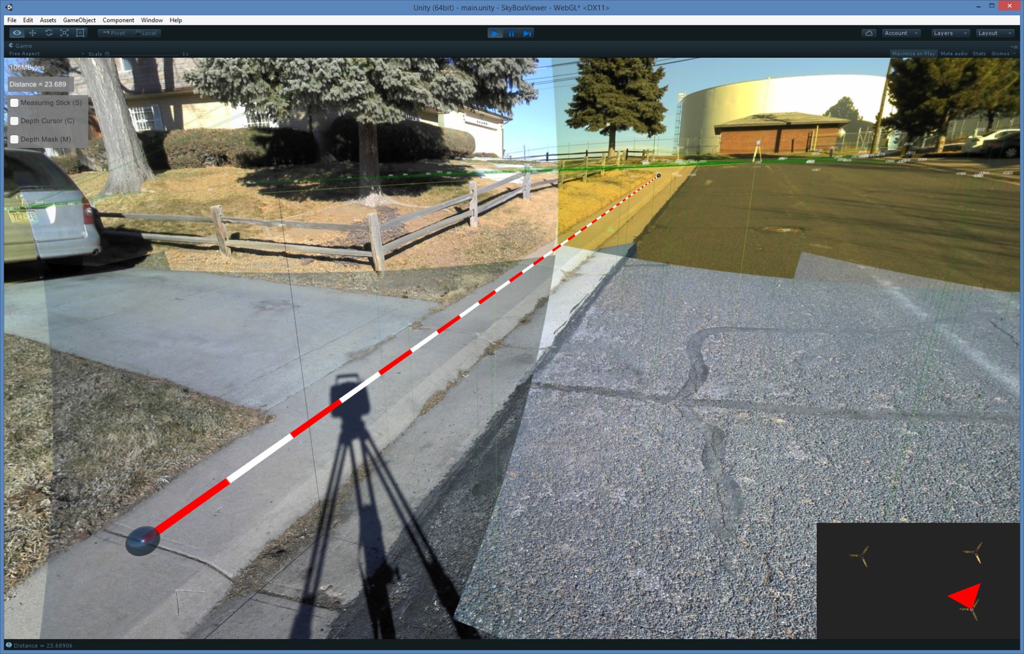
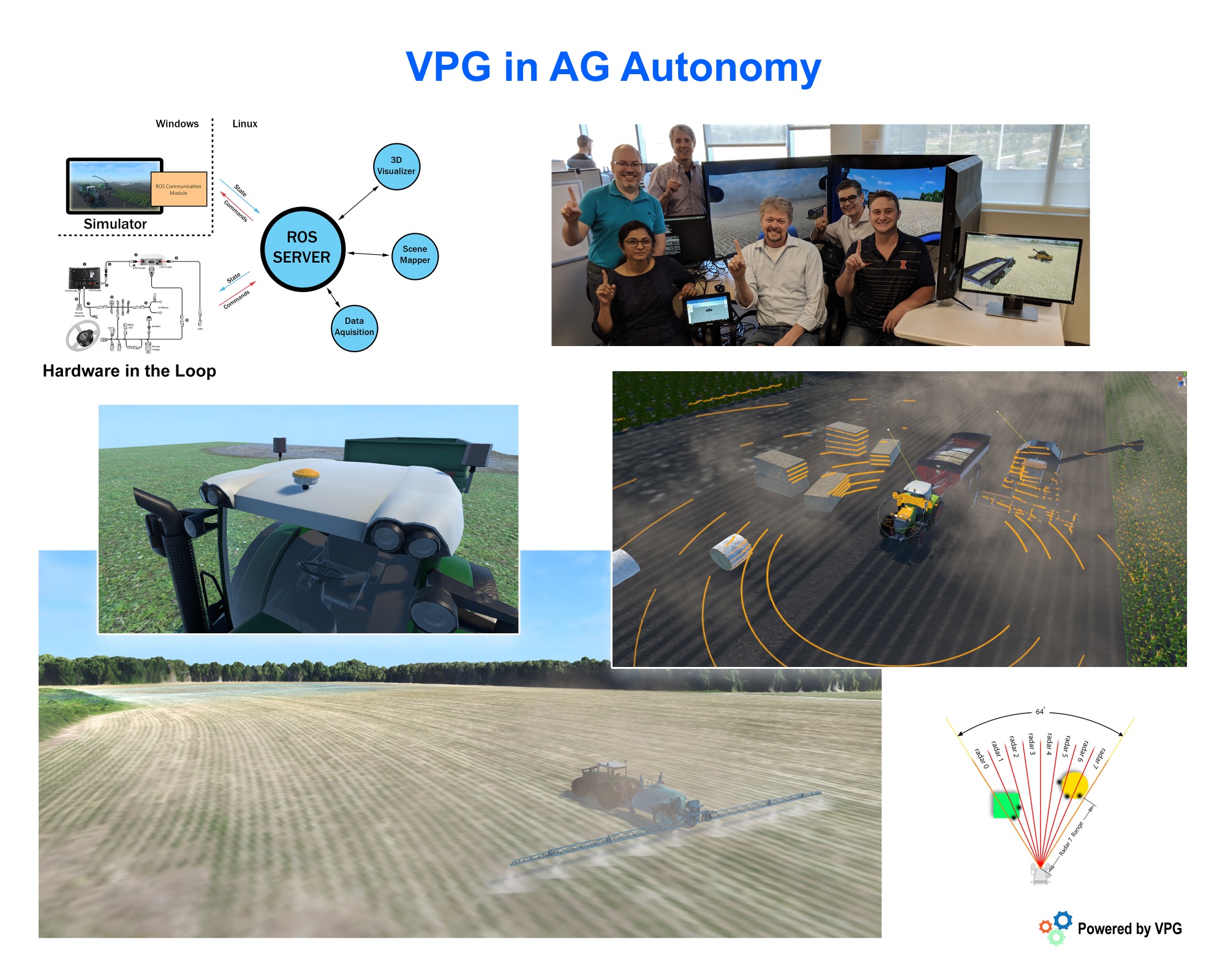
Ag Autonomy Simulator (2017-2018)
Company: Trimble
Custom Simulation framework for Trimble Agriculture.
Contributions
Develop a Unity 3D configurable simulation framework that enabled Trimble testers and developers to try new systems and algorithms inside a virtual sandbox so they did not have to rely on real vehicles all the time. Developed a new suite of virtual sensors (i.e. Lidar, Radar, Cameras, IMUs, GPS) capable of producing real-time signals that matched the real counterparts.
Impact
This framework allowed the creation of new vehicles in a few days instead of months. This simulation solution enabled developers to discover issues much faster due to the accessibility of the simulators and the ground truth data which is difficult to obtain with real vehicle testing.
Role: Architect and Main Developer

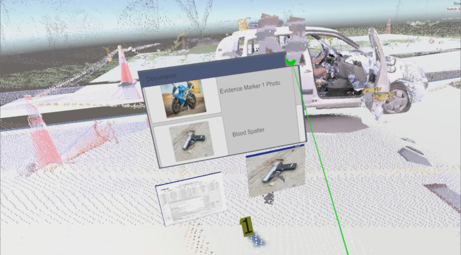
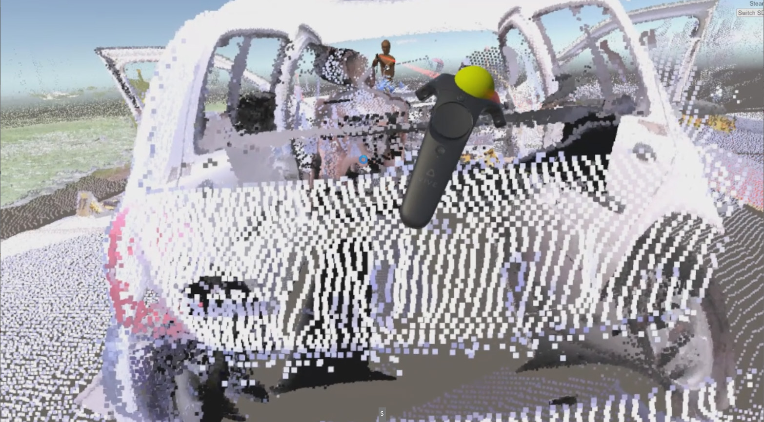
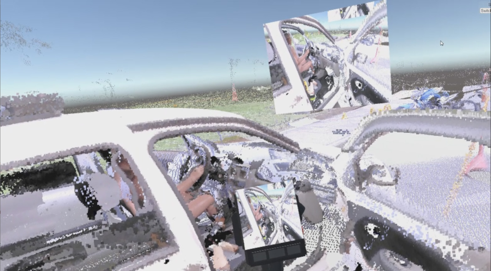
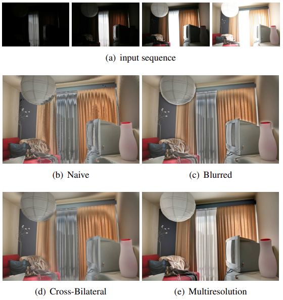
VR Forensics (2017)
Company: Trimble
Development of VR Technologies to solve accident and crime scene reconstruction.
Contributions
Conceived and developed an immersive solution to visualize, preserve and manipulate forensics evidence for crime and accident scenes.
Impact
This effort injected new life into a business area that needed to catch up with the latest technologies.
Role: Concept Creator, Evangelist and Main Developer
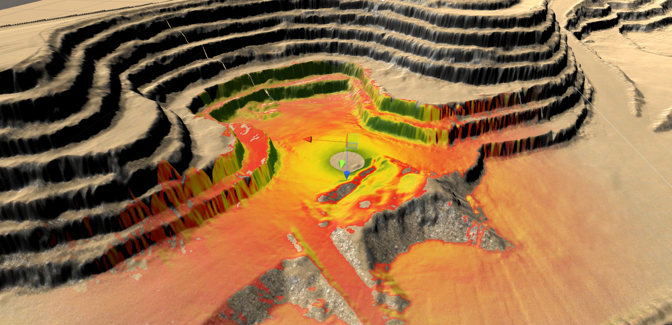
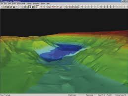
Connected Mine (2015)
Company: Trimble
Simulation test bed for the Connected Mine (A real-time monitoring solution for mining operations).
Contributions
Created a new technique to visualize microwave radar data onto a live terrain. Developed mining assets (vehicle and sensors) to validate the system using real-time simulation. Also, developed a mining terrain generation tool to test the terrain visualization and tracking solutions.
Impact
This worked impacted the live mine project as well as T4D (Terrasat).
Role: Main Developer
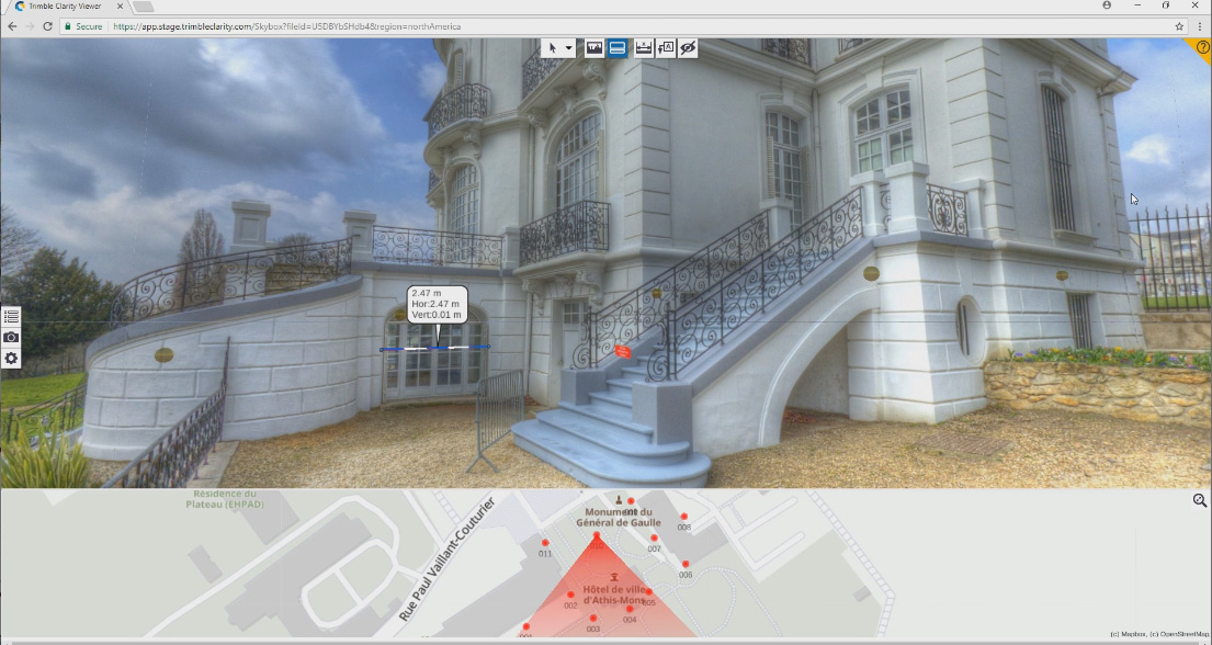
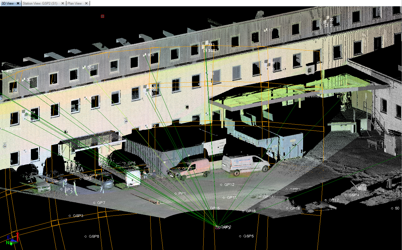
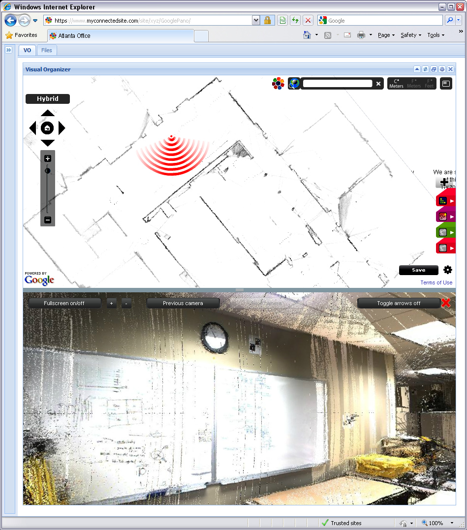
Trimble Clarity (2014-2015)
Company: Trimble
Cloud based point cloud visualization solution for surveyors.
Contributions
Developed the original version of Trimble clarity that fulfilled the requirement: Give clients access to point cloud data sets but don't give them the point cloud. This version rendered skyboxes created in TBC in a web-based application where users could visualize, annotate and measure station based views.
Impact
This solution got Trimble Clarity off the ground and was used by hundreds of Trimble users. This technology was also re-used in several Trimble projects.
Role: Co-developer

Hololens (2014)
Company: Trimble & Microsoft
Co-development of the Hololens launching demo for Architecture in collaboration with Microsoft.
Contributions
Developed a new technique to project panoramas onto 3D geometry using projection shaders. The early work conducted alongside Microsoft setup the foundation to develop Augmented reality solutions using Unity 3D.
Impact
The hololens project became a major technological advance for Trimble and open a new era for solutions that placed the digital world right into the real one.
Role: Research
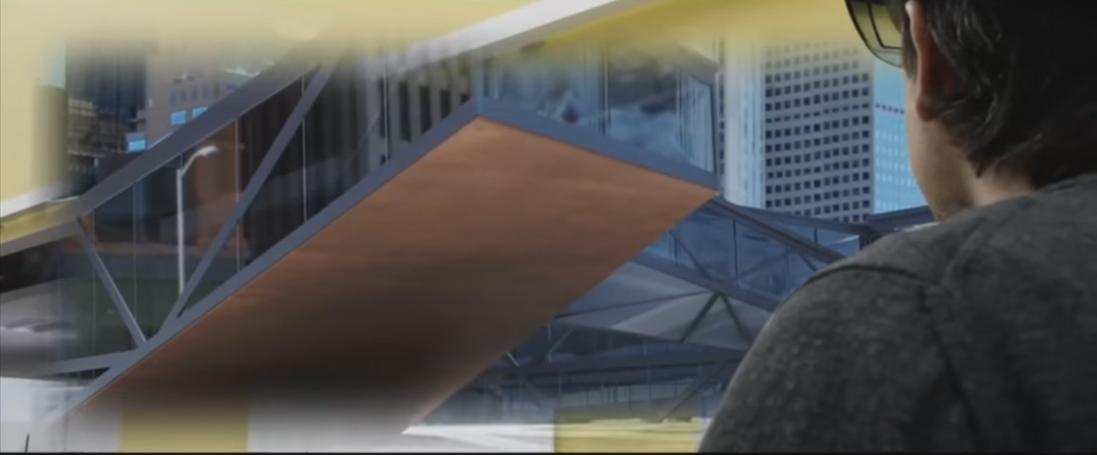
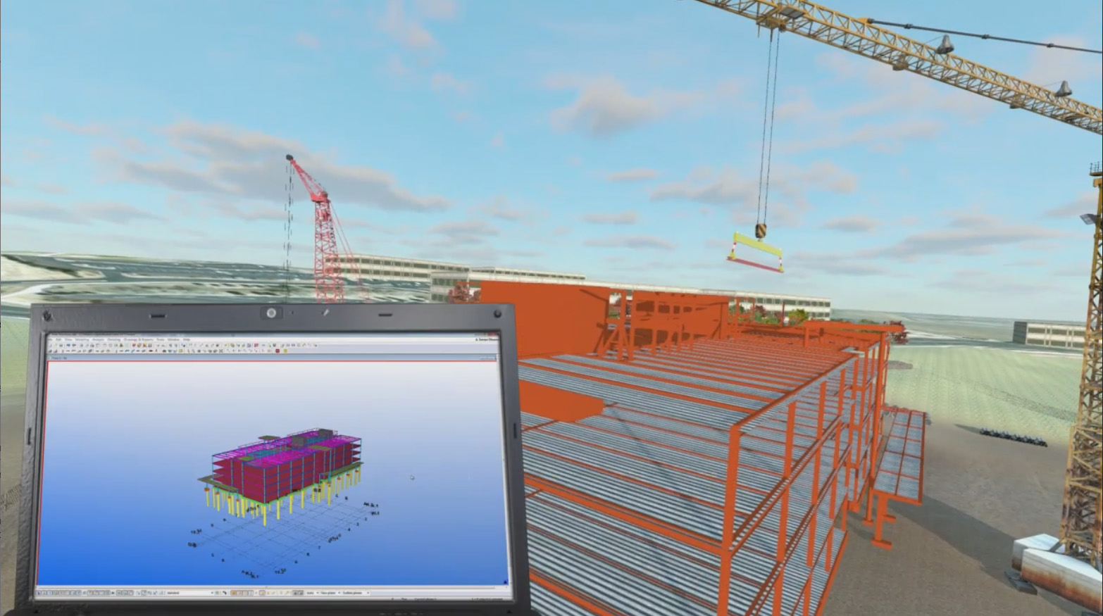
Trimble Story (2014)
Company: Trimble
Video project that depicts the use of Trimble Technologies and Solutions to execute the entire lifecycle of a Building Construction Project.
Contributions
This was a massive marketing project that repurposed simulation assets developed for a variety of projects to create a compelling narrative that explains how Trimble's construction portfolio can carry an entire Building project from beginning to end.
Impact
This video was showcased in 2014 to a large group of wall street analysts. It provided the C-Level tier of Trimble a way to easily illustrate and prove the value of the company.
Role: Project Manager & Main developer
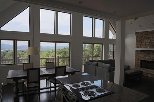
Exposure Fusion (2014)
Company: Trimble
This feature allows a TBC user to blend multiple exposure photographs into an HDR like result.
Contributions
Developed a GPU based implementation of the original CPU based algorithm and reduced the execution time by 3 orders of magnitude.
Impact
This is still being used in TBC and resulted in a patent for Trimble.
Role: Research and Main Developer
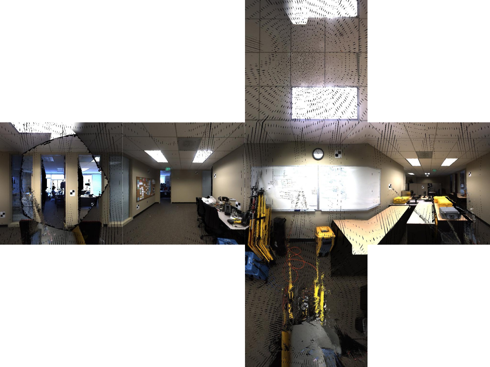
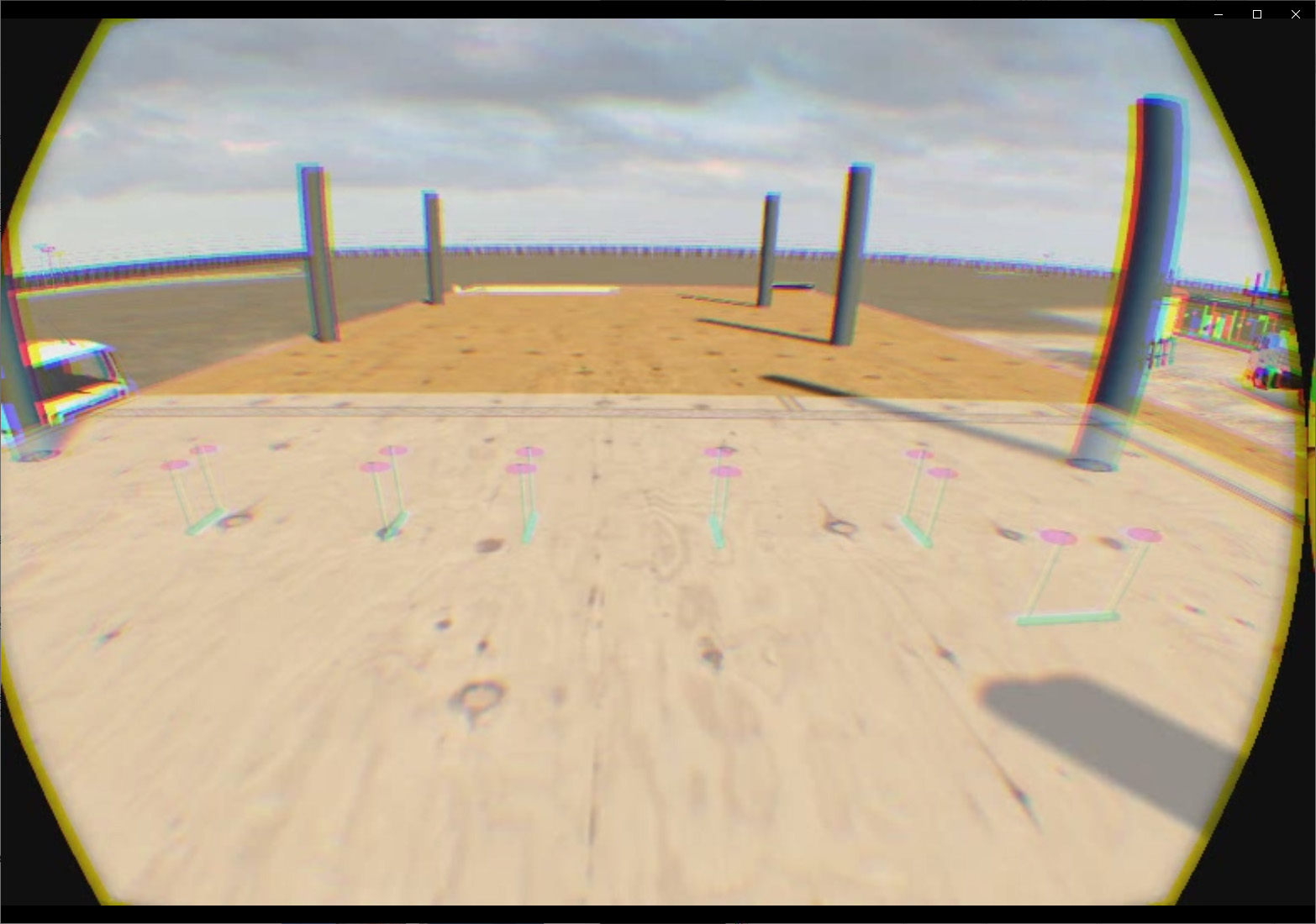
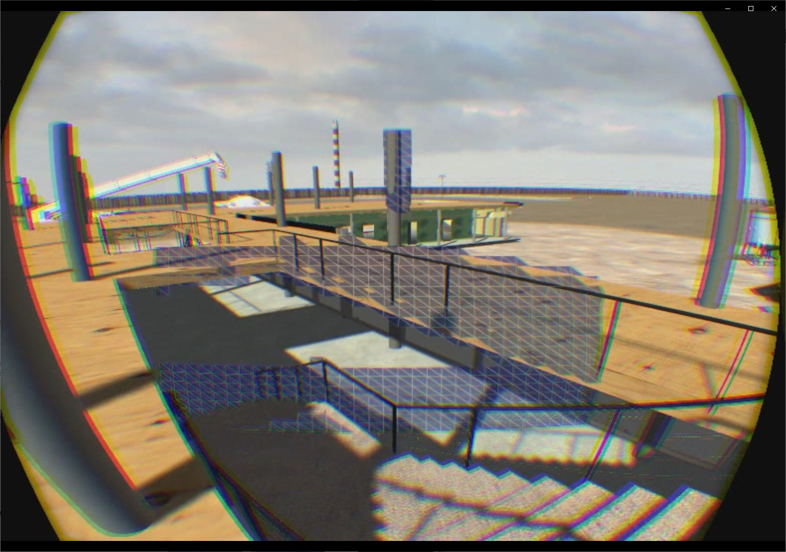
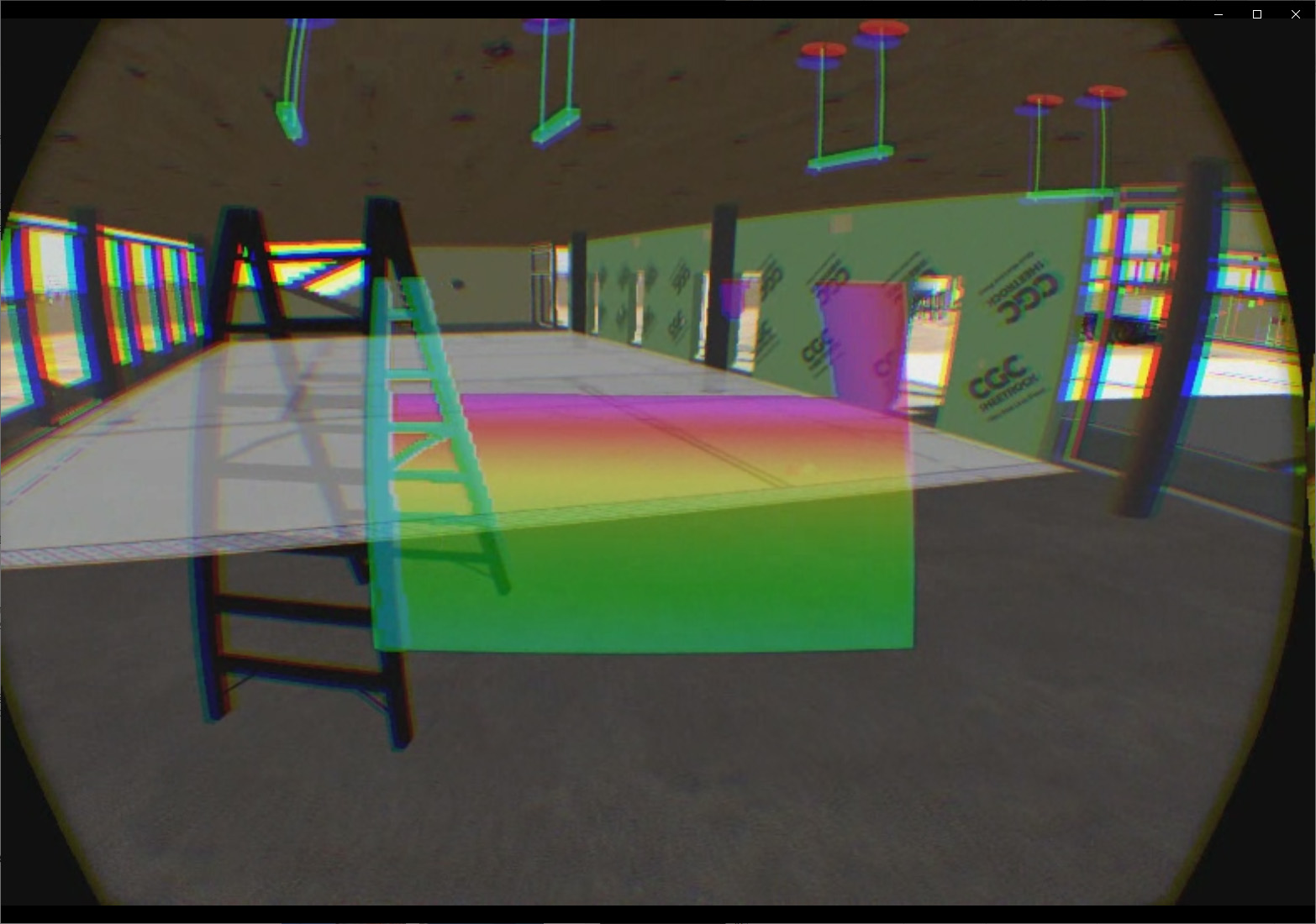
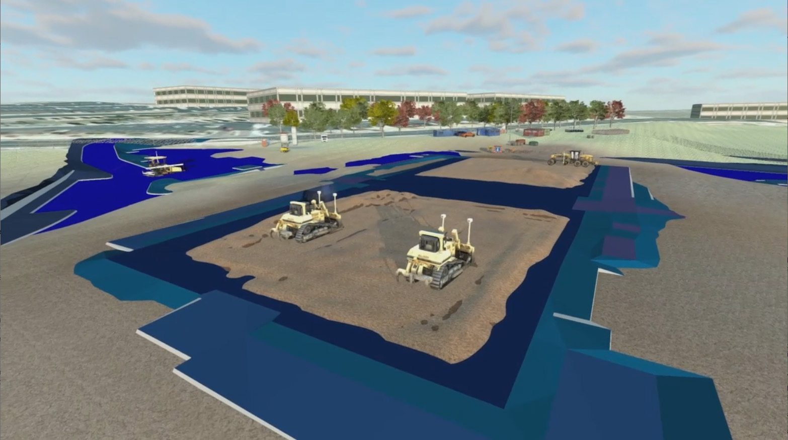
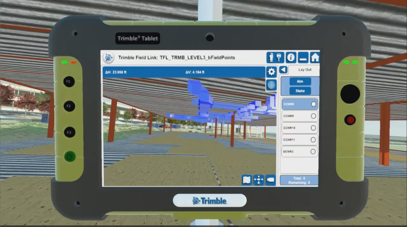
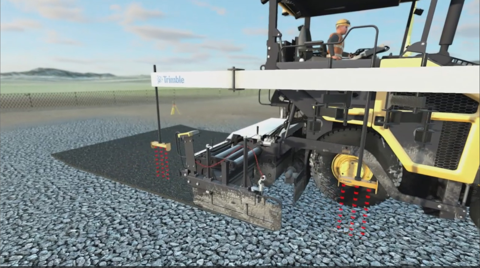
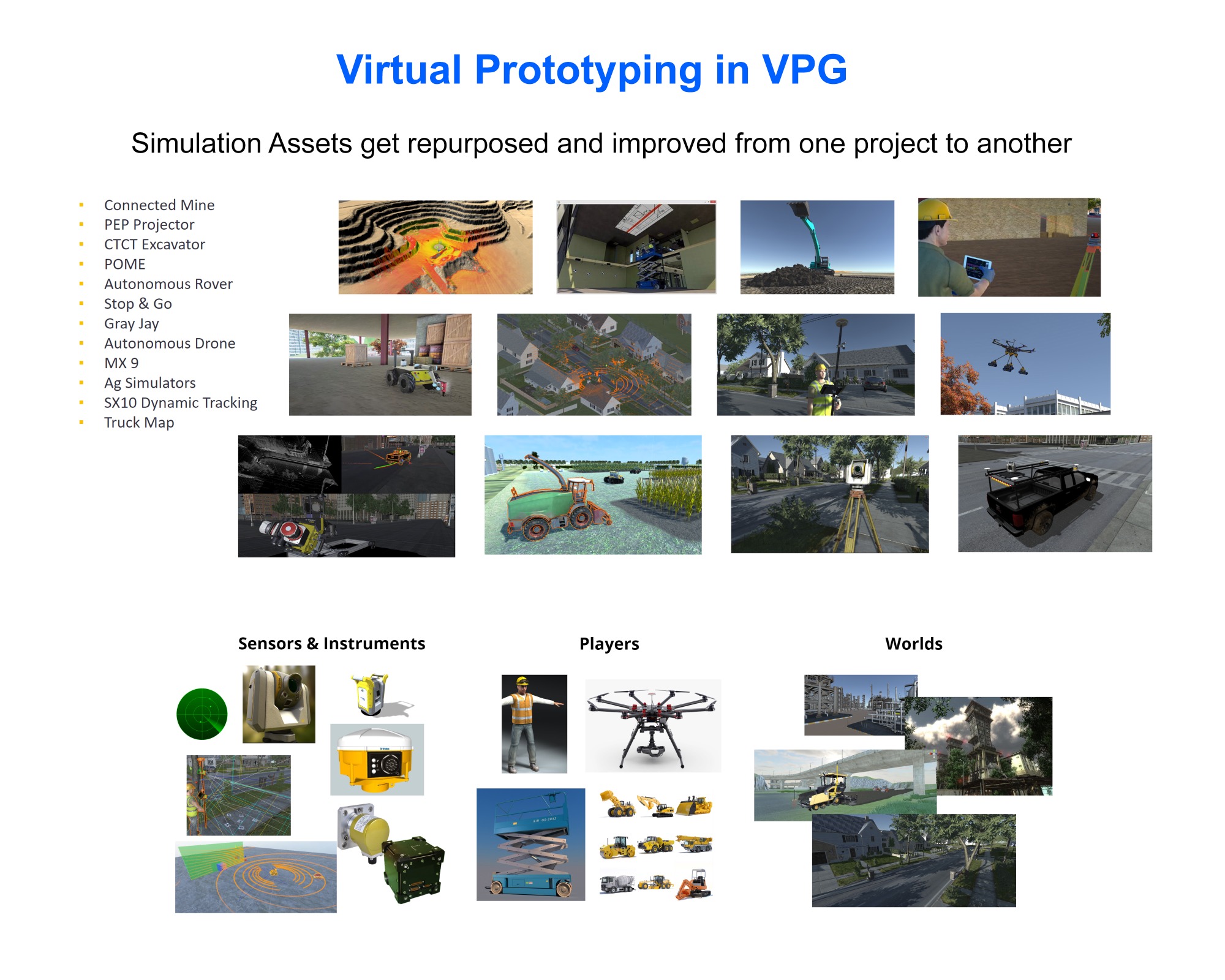
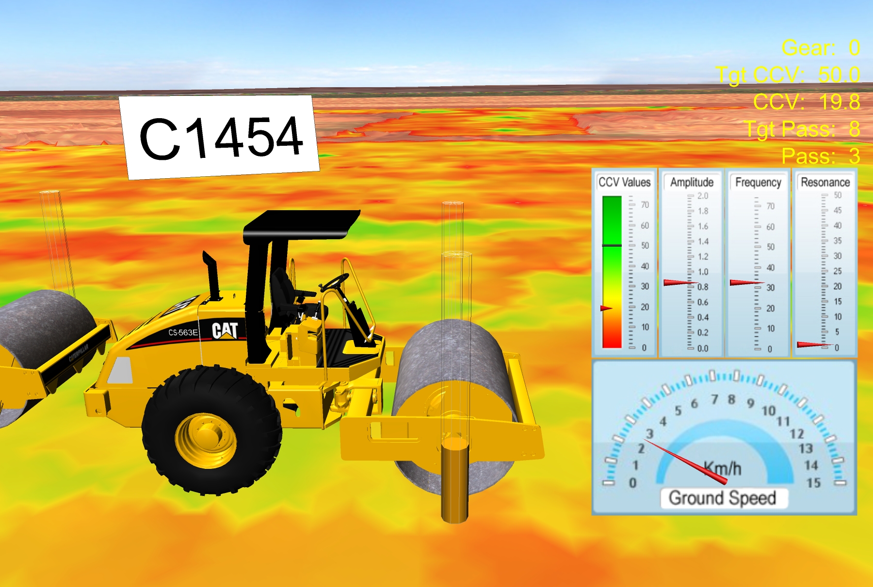
VPG (2013-2023)
Company: Trimble
The Virtual Proving Ground is a framework that promotes the use and sharing of high fidelity simulation solutions across project phases.
Contributions
Developed an entire framework of simulation technologies that facilitates the creation of high fidelity simulations of vehicles, sensors, and scenes. The framework provides distinctive modes of interacting with the simulated actors (vehicles, machines, and avatars) so they can be controlled interactively, by network commands (sent by external applications), and by predefined scripted sequences.
Impact
VPG has been used in the promotion of concepts (way before solutions are developed), testing and validation of new technologies and algorithms, promotion of products, and training and education of Trimble users during the last 10 years.
Role: Concept Creator, Evangelist and Main Developer
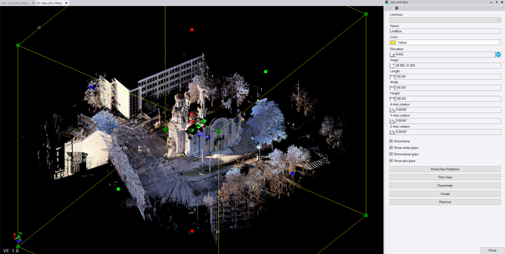
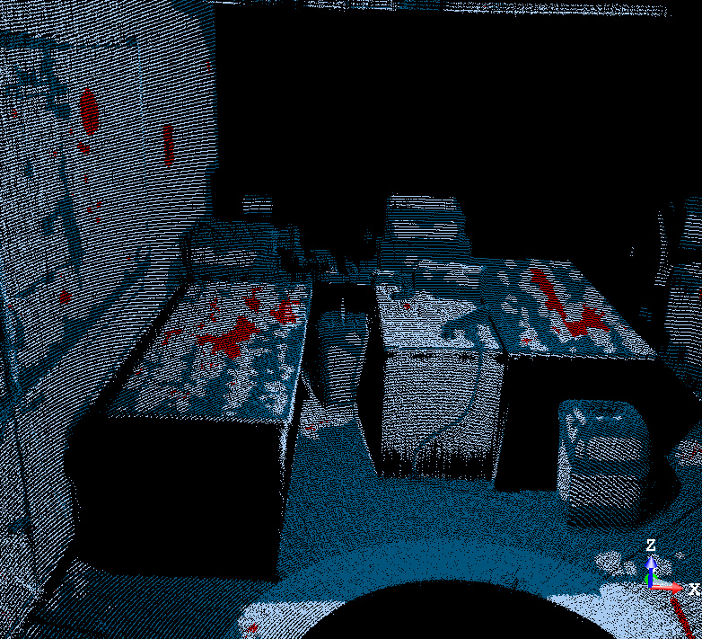
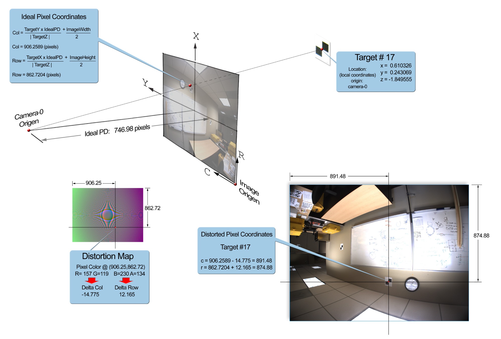
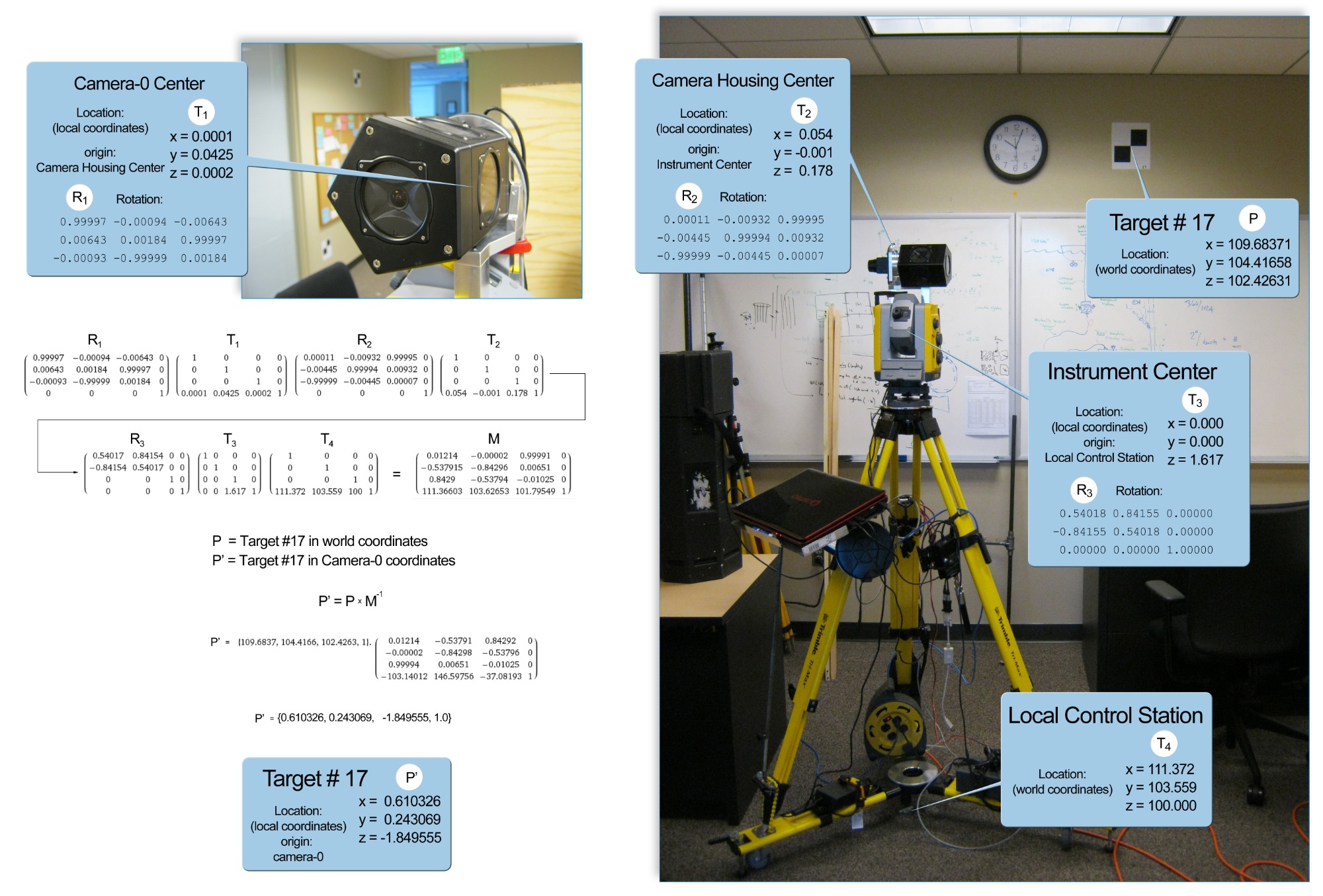
Point Cloud Colorization (2013)
Company: Trimble
This feature allows a TBC user to colorize a point cloud using the photos collected at a station.
Contributions
Developed the first algorithm in TBC that used a compuational shader to perform the ray-to-image intersection computation for every point in the cloud dataset. This method performed several orders of magnitude faster than traditional CPU based approaches.
Impact
This is still being used every time a TBC user imports a point cloud datasets in TBC.
Role: Research and Main Developer
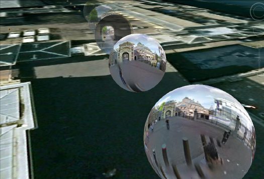
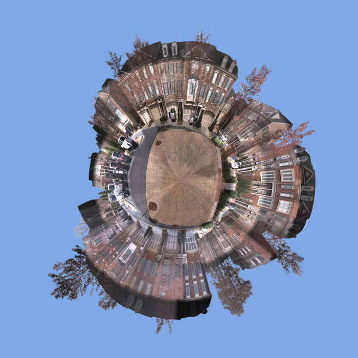
Google Earth Exporter (2013)
Company: Trimble
This features allows a TBC user to create a google earth panorama using VX10 data. Later versions were adapted to support other Trimble instruments like the SX10
Contributions
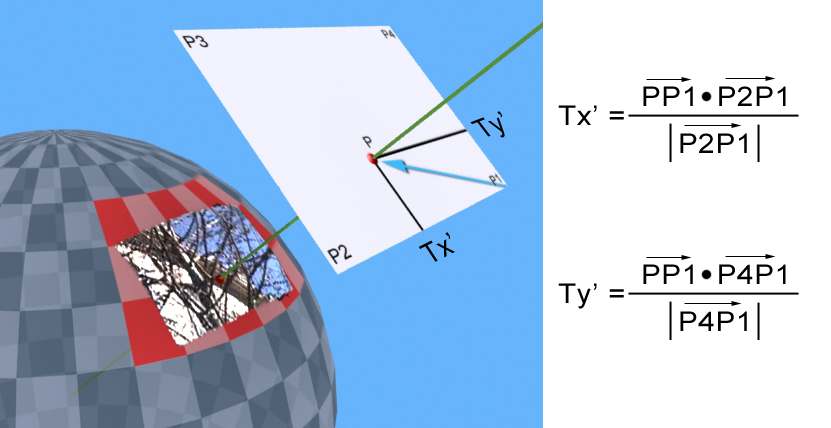
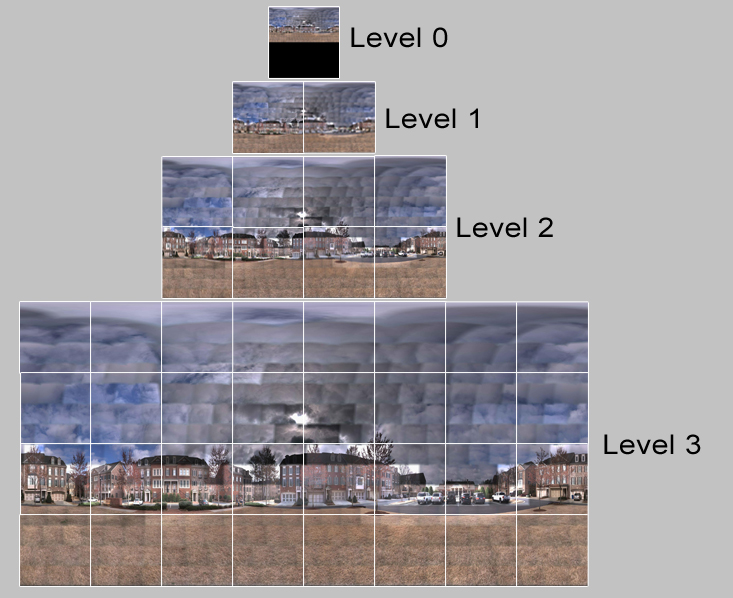
Created the Equi-rectangular rendering routines for the multi-resolution panorama generation using GPU technology.
Impact
This became a very popular feature in TBC that is still used today by thousands of users to showcase their projects in Google Earth.
Role: Research and Main Developer
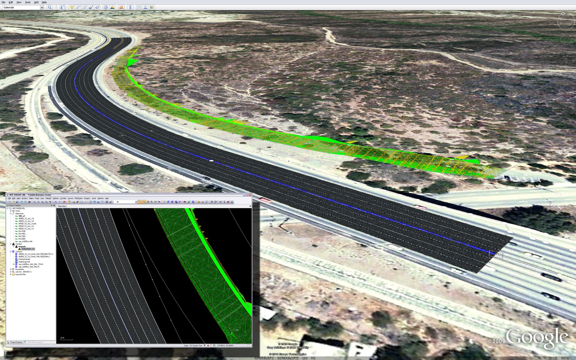
TBC (2012-2018)
Company: Trimble
Trimble Business Center is a core Trimble software that provides solutions to Surveyors and Civil Engineers.
Contributions
Provided state of the art rendering techniques within the constrains imposed by the underlining application framework (HOOPS). Developed the Image capture command. Implemented texture mapping on surfaces. Implemented material textures with standard u/v mapping and station/offset mapping for corridors. Developed the 3D capture command. Developed plot boxes. Created the Equi-rectangular rendering routines for the process image command using a new technique. Developed the Image boundary command which allows users to clip an image using TBC line primitives as boundaries. Developed image filters that allow TBC users to dim, de-saturate and colorize images.
Impact
These features and commands have had a great impact in the feature portfolio of TBC. Most of the commands listed here were developed using GPU methods which drastically reduced the time of execution.
Role: Member of Core Development team
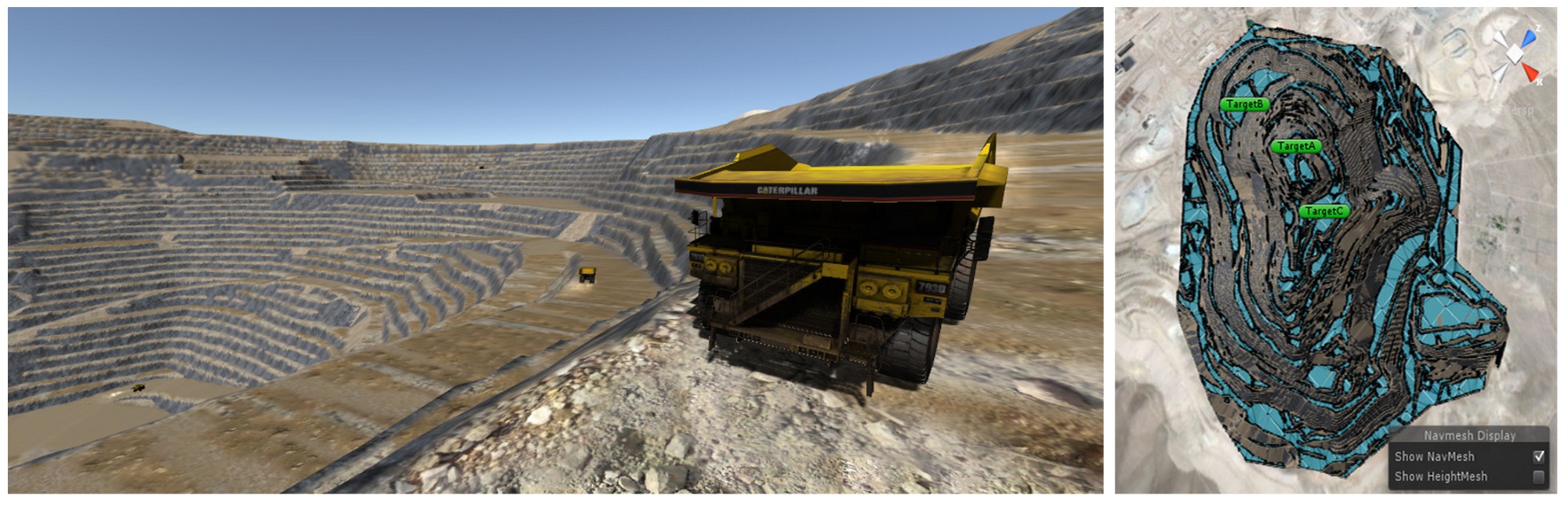
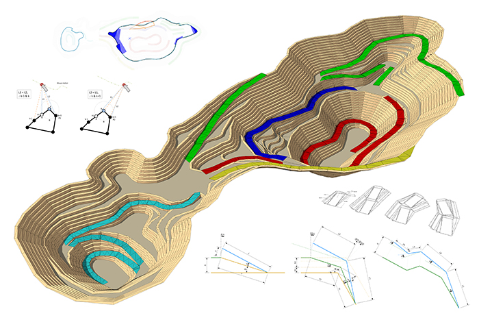
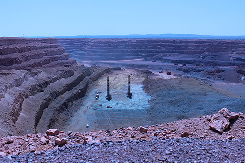
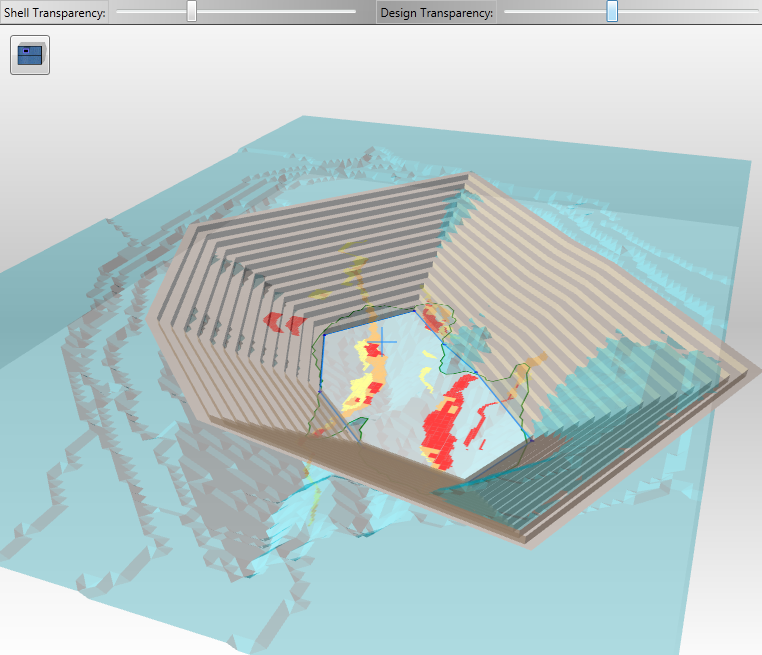
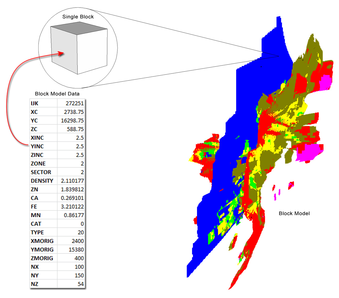
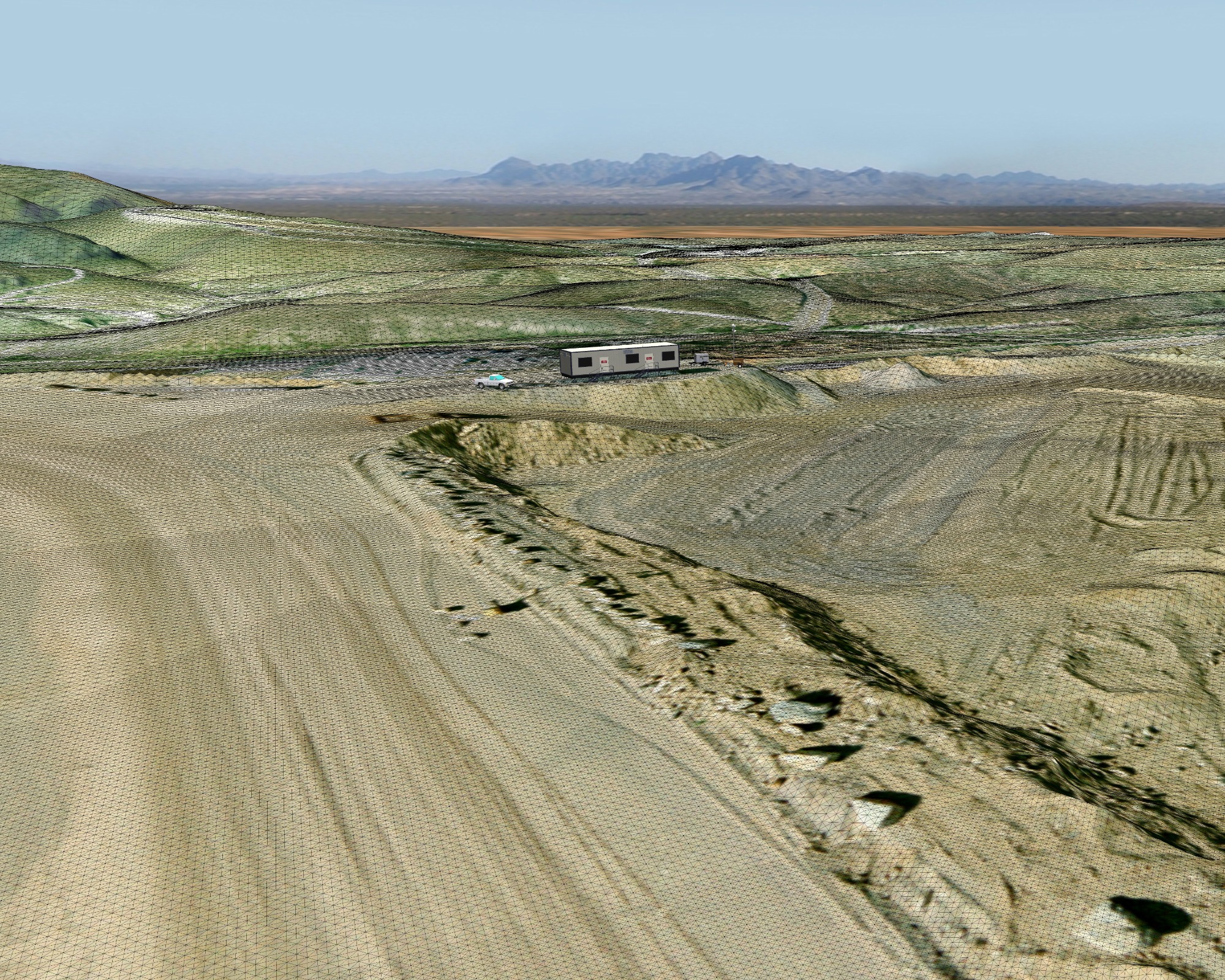
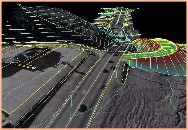
Open Pit Designer (2011-2012)
Company: Trimble
Parametric Open Pit design application that simplifies the entire design process by capturing the true intent: Getting the most ore under current economic constraints.
Contributions
Co-developed a novel technique that enables users to capture ore at different elevations using a derived outline. The algorithm propagates the outlines following bench parameters and road starting locations. The fast computation of a new design allows users to make quick adjustments every time the economic factors change. Developed novel GPU based rendering algorithm that slices the ore data and generates cross-sections in real-time.
Impact
This application revolutionized the industry and saved customers millions of dollars by allowing quick re-designs of their mining plans.
Role: Graphics Architect and Co-developer
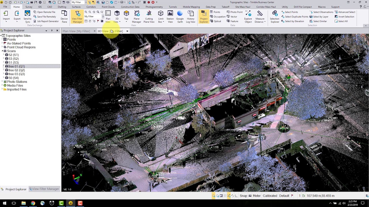
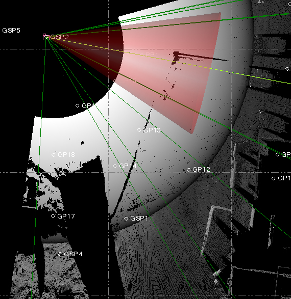
TCC - Scan Visualizer (2010-2011)
Company: Trimble
Trimble Connected Community component designed to visualize and colorize point clouds.
Contribution
Developed novel technique to rapidly colorize scan data using GPU algorithms. This was the first time this was done in Trimble. This was presented to the Board of Directors to make them aware of the incredible power of GPUs and their potential to drastically improve the performance of existing and future Trimble technologies.
Impact
This technique was tested under the TCC product and was later repurposed in the Black Glass Project (see Trimble Clarity project details).
Role: Researcher and Developer
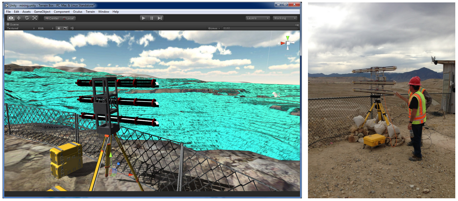
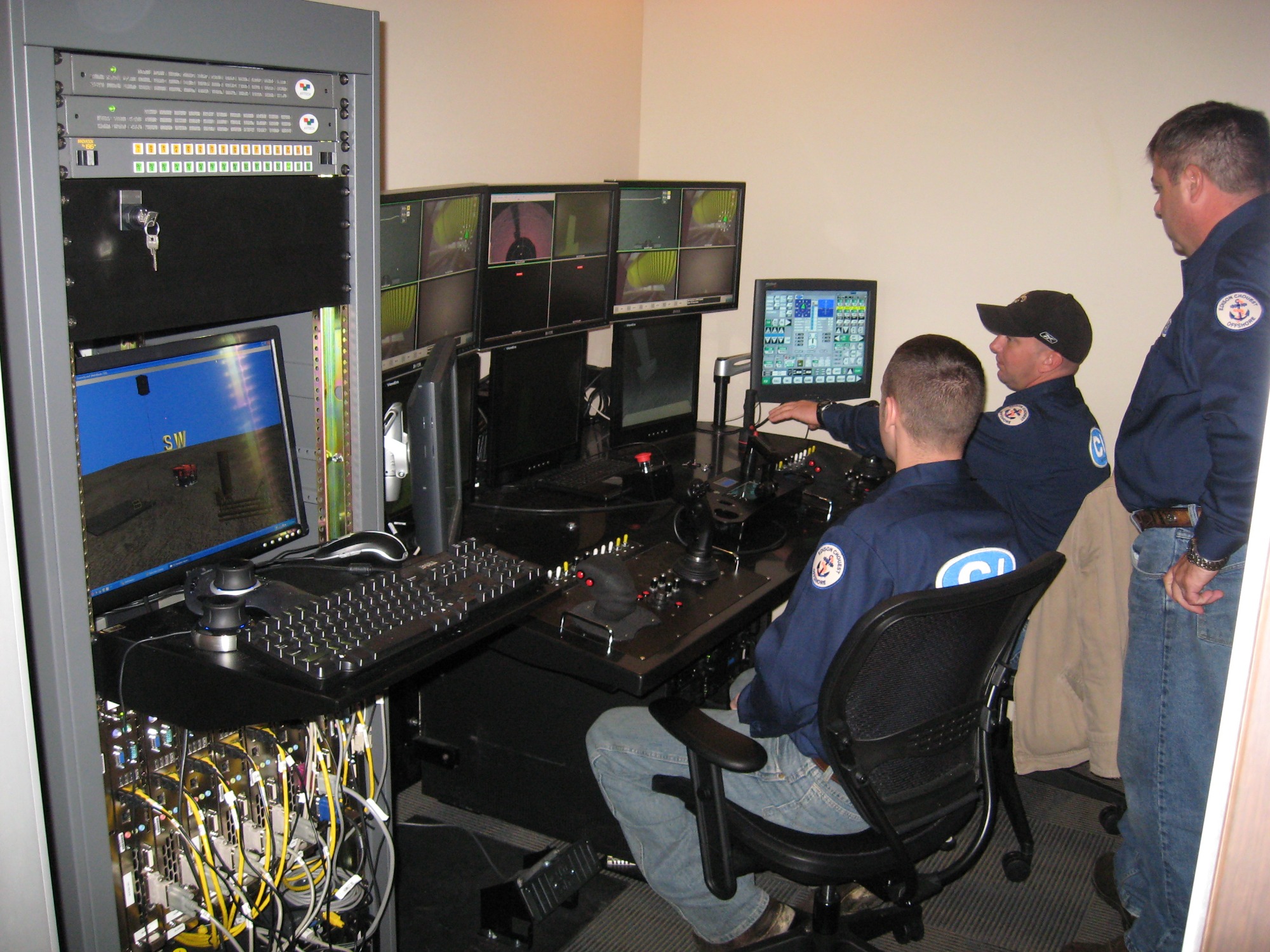
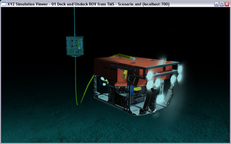
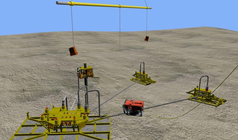
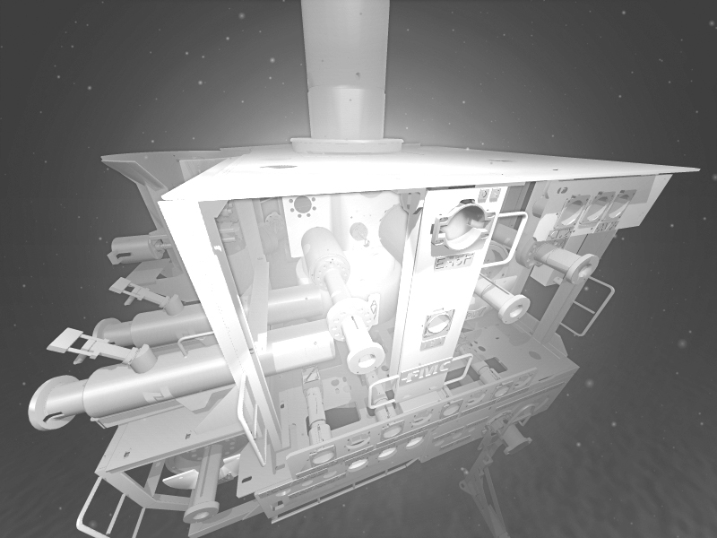
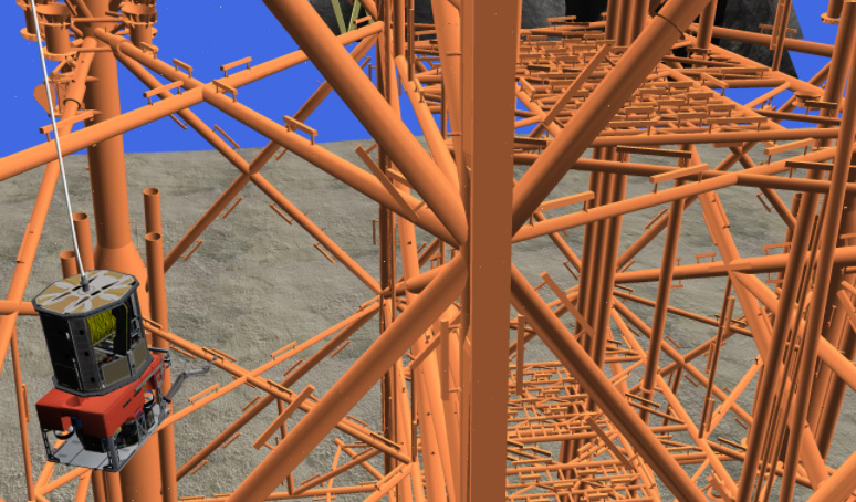
ROV Simulator (2009-2011)
Company: Trimble
Training simulation solution developed to interact with the real ROV control station. This system ran on 9 computers and provided multiple camera feeds. This system also provided a virtual sonar sensor that communicated with the actual sonar display hardware.
Contributions
Developed novel techniques to render light reflected on scattered particles. Developed novel technique to render umbilical cord spooling mechanism. Developed novel technique to simulate underwater light wave absorption behavior. Novel technique to simulate a sonar sensor.
Impact
This product was licensed to C-Innovation. Hundreds of ROV operators were trained using this solution.
Role: Graphics Architect and Co-Developer
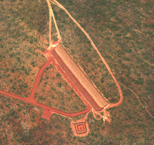
JRAC (2005-2006)
Company: XYZ Solutions
Airfield parametric design software developed for the US Army.
Contributions
Co-Developed a novel technique to generate a custom airfield using high level user input: location, target airplanes, taxiway placement, apron placement, and other basic elements. Final design was compatible with machine control solutions.
Impact
This solution enabled the US Army to drastically expedite the process of deploying personnel and resources to remote tactical areas. It also provided a way to design a solution in a fraction of the time required by traditional methods.
Role: Co-Architect and Co-Developer
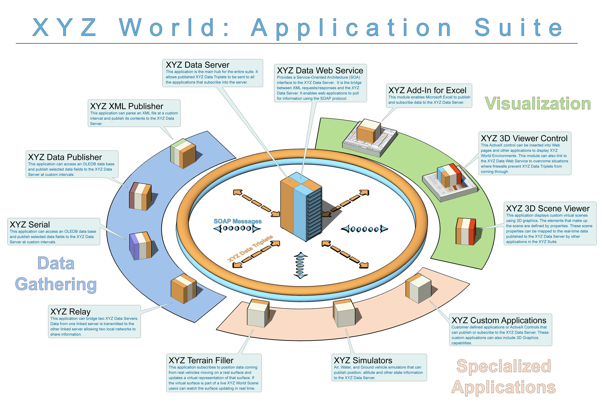
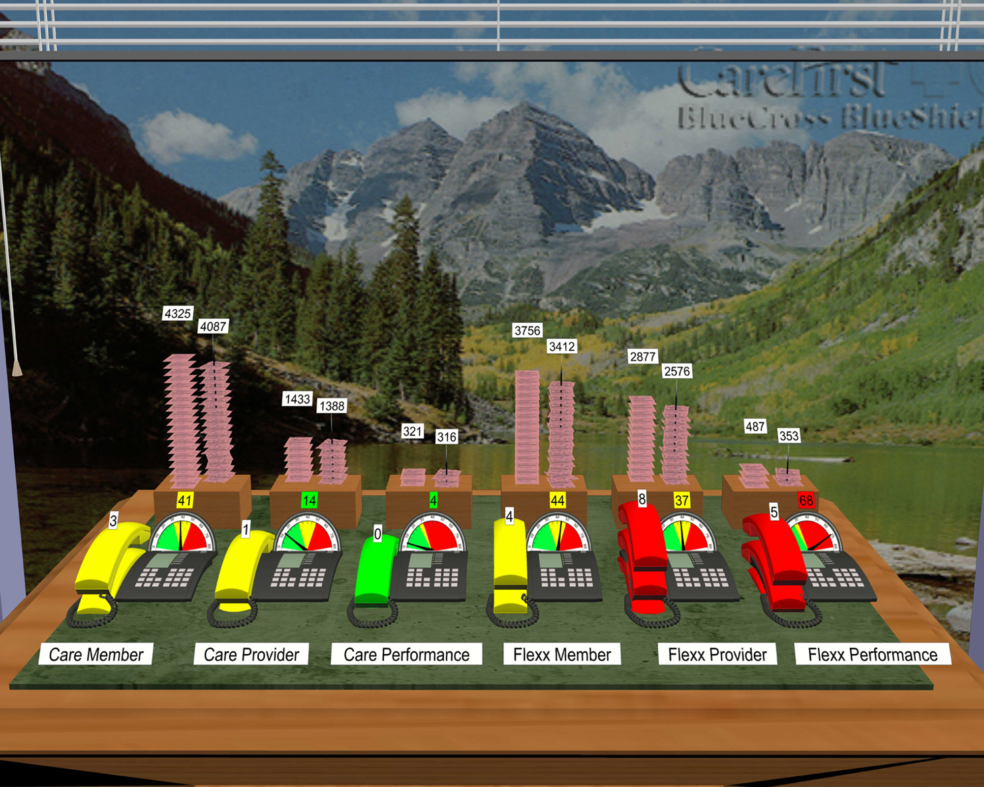
XYZ World (2001-2009)
Company: XYZ Solutions & Trimble
Comprehensive Real-Time Visualization with a publish and subscribe foundation framework.
Contributions
Mapping real-time parameters to graphical properties. Novel communication protocol (XYZ Triplets) that used value, name, units to describe any possible real-time attribute. Novel technology to update surface topology in real-time using vehicle pos.
Impact
This framework was the foundation for hundreds of customer solutions expanding a vast array of domains. It was adopted by NASA and Caterpillar for advanced R&D projects in 2006.
Role: Co-Architect and Co-Developer

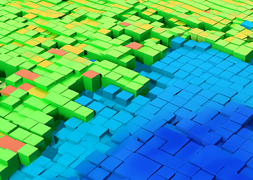
MRGRID (2000)
Company: XYZ Solutions
Multi-Resolution Grid. Visualization library capable of rendering large terrain grids using view dependent LODs.
Contribution
This technology introduced the concept of grid cells. The elevation and color of the surface could come from configurable cell parameters.
Impact
This library secure the first commercial contract of XYZ Solutions and was later adopted under the XYZ World.
Role: Architect and Main Developer

VEM (1998-1999)
Company: Spectra Precision
Virtual Environment Manager SDK. An MFC library for real-time monitoring and visualization applications.
Contribution
Encapsulation of OGL technologies under a View-Document-Model framework.
Impact
Enable Windows developers to create custom real-time tracking solutions without having to master 3D Graphics.
Role: Architect and Main Developer

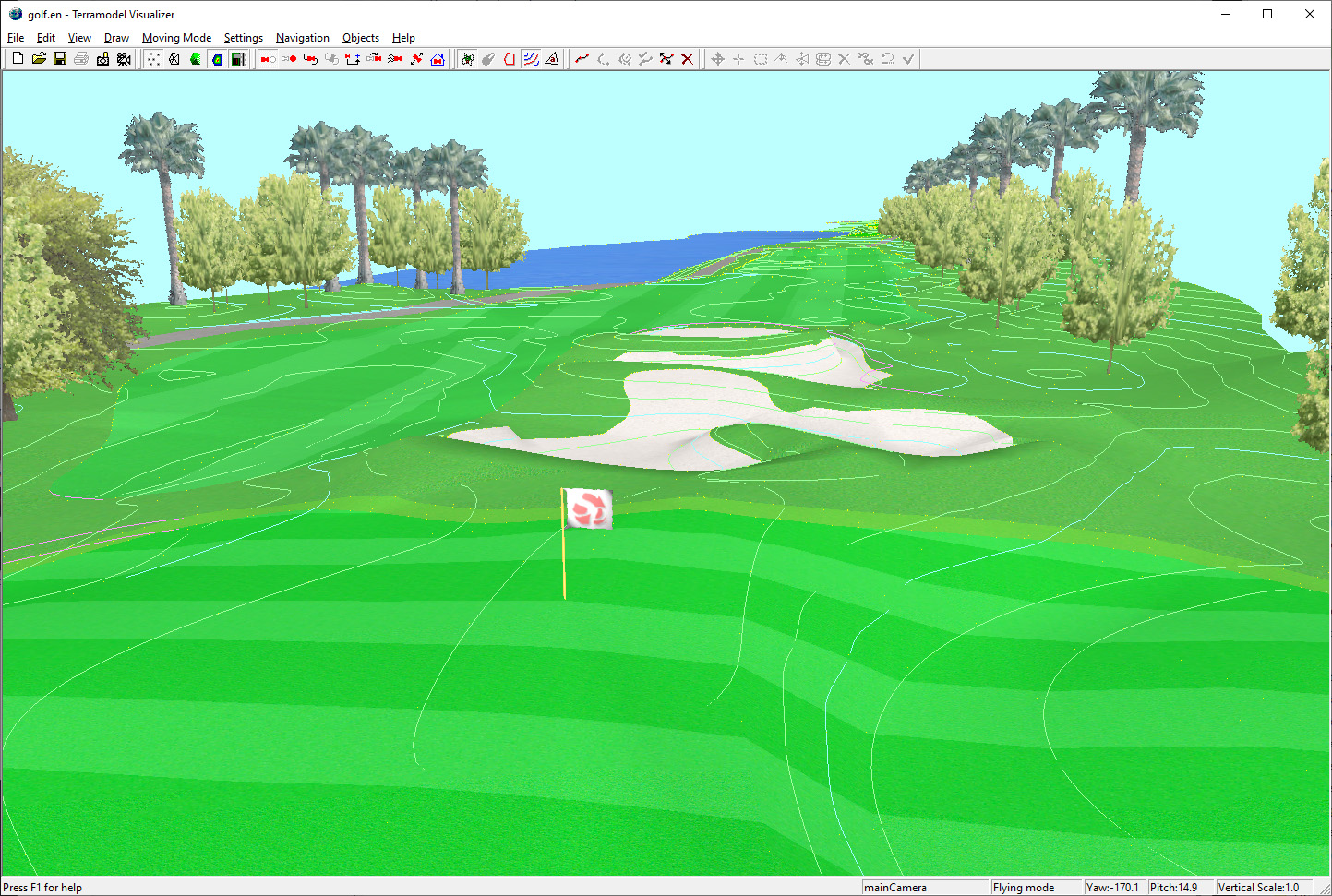
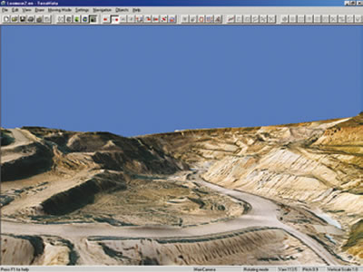
TerraVista (1997-1998)
Company: Spectra Precision
Visualization Application for Terramodel.
Contributions
Civil Engineering CAD 3D rendering visualizer with interactive camera path tool, support for EROs (Patented Technology).
Impact
Thousands of copies sold. Rendering technologies will later impact VEM and XYZ World.
Role: Architect and Main Developer
Augusto Opdenbosch
© Copyright. All rights reserved.
We need your consent to load the translations
We use a third-party service to translate the website content that may collect data about your activity. Please review the details and accept the service to view the translations.